Radin 3D
3D Laser Scanning & BIM Modeling | Radin AG







Our Services
From millimeter-accurate 3D scanning to full-scale Revit models, our services help you move faster, reduce errors, and build with total confidence.

3D Scanning
Capture every detail with unmatched precision. Our advanced laser scanning collects millions of spatial data points at millimeter accuracy, allowing you to plan, design, and build with total confidence. The result? Faster workflows, fewer errors, and data your entire team can trust.

%201%20(1).jpg)

3D Modeling (LOD 100–400)
Accurate Revit models tailored to your needs. We transform point cloud data into highly detailed 3D models using REVIT, supporting every phase of your project. Whether you need conceptual massing or fabrication-level detail, we offer the right LOD for the job.

2D Drawing
We turn scans into precise 2D drawings produced to architectural standards. Based on the point cloud, we create floor plans, sections, façades, and details that faithfully represent the existing condition of the building and provide a reliable basis for design, reconstruction, or technical documentation.
.jpg)
Our Work
.jpg)
Scanning for the Creation of a Replica of a Protected Facade


Hotel Staro Zdanje – Laser Scanning and Digital Documentation
%201%20(1).jpg)
Scanning and Modeling of Rajko Mitić Stadium (Marakana)
.jpg)
As-Built Scanning of the Overpass – Novi Sad–Subotica Railway
.jpg)
Preparation for the Reconstruction of a Commercial Building
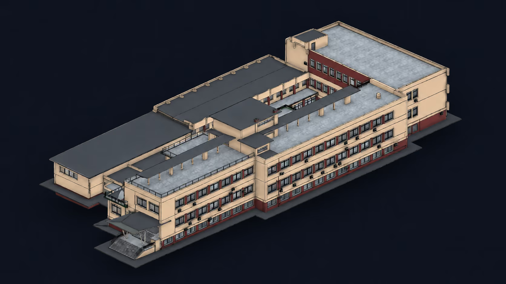
Clinical Center of Vojvodina – 3D Scanning, Modeling, and 2D Documentation
.jpg)
Fenek Monastery – Laser Scanning and Detailed 3D Modeling
Customer testimonials


Cooperation with Radin AG was completely professional and efficient. We received the requested point cloud model of the location, as well as geodetic survey data of the parcels, in the shortest possible time, with an extremely precise and clear point cloud model. They were also very willing to accommodate all of our additional requests, as well as to provide the necessary software support for a clearer understanding of the location through the delivered survey data. In any case, we give them our absolute recommendation, and our intention is to continue working with Radin AG for all geodetic surveying services.

As a designer, I had the opportunity to collaborate with GeoRadin on several domestic and international projects. Their geodetic work, 3D laser scanning and 3D modeling are distinguished by high precision, reliability and a professional approach, which is why I highly recommend them as a collaborator.

Since we started using their 3D scanning service, we no longer need to rely on repeated, time-consuming site visits—saving valuable time and ensuring we always have precise, up-to-date spatial data. What’s more, having full 360° photo documentation means we can revisit every detail of the space at any time, which is especially crucial for projects located outside our city. This unique service has also elevated our professional image toward clients, reinforcing trust and positioning us as a reliable, tech-forward partner in every phase of the project.

An exceptionally professional facade 3D scanning service. The point cloud they delivered was millimeter-precise, which drastically simplified the creation of project documentation without the need for repeated site visits.

Radin has been our reliable partner for several years and we are grateful to them for helping us raise the precision of our projects to a new level. In addition to the technology and equipment they possess, they provide quality support and service throughout the entire process of creating documentation. With their help, our processes have become more reliable, more practical and faster, and their service has become our standard on complex projects.

Cooperation with Radin AG was completely professional and efficient. We received the requested point cloud model of the location, as well as geodetic survey data of the parcels, in the shortest possible time, with an extremely precise and clear point cloud model. They were also very willing to accommodate all of our additional requests, as well as to provide the necessary software support for a clearer understanding of the location through the delivered survey data. In any case, we give them our absolute recommendation, and our intention is to continue working with Radin AG for all geodetic surveying services.
As a designer, I had the opportunity to collaborate with GeoRadin on several domestic and international projects. Their geodetic work, 3D laser scanning and 3D modeling are distinguished by high precision, reliability and a professional approach, which is why I highly recommend them as a collaborator.
Since we started using their 3D scanning service, we no longer need to rely on repeated, time-consuming site visits—saving valuable time and ensuring we always have precise, up-to-date spatial data. What’s more, having full 360° photo documentation means we can revisit every detail of the space at any time, which is especially crucial for projects located outside our city. This unique service has also elevated our professional image toward clients, reinforcing trust and positioning us as a reliable, tech-forward partner in every phase of the project.
An exceptionally professional facade 3D scanning service. The point cloud they delivered was millimeter-precise, which drastically simplified the creation of project documentation without the need for repeated site visits.
Radin has been our reliable partner for several years and we are grateful to them for helping us raise the precision of our projects to a new level. In addition to the technology and equipment they possess, they provide quality support and service throughout the entire process of creating documentation. With their help, our processes have become more reliable, more practical and faster, and their service has become our standard on complex projects.
Why Clients Choose Radin AG
30+ years of proven experience, cutting-edge technology, and a reputation for precision, here’s what sets us apart.

Decades of Experience
30+ years delivering reliable geodetic surveying and modeling across Europe.

Advanced Technology
We use the latest laser scanning and BIM tools for precise, efficient results.

End-to-End Accuracy
From scanning to Revit modeling, we ensure every detail is accounted for.

Fast Turnarounds
Projects are completed quickly without sacrificing quality or precision.